
Sentinel-2 natural colour, 8 Dec 2025, 10 m pixels.
NDVI. Blue water, brown bare soil, green crop, darkest green forest.
NASA EMIT, 18 Feb 2026, 60 m. Brighter means a deeper absorption band.
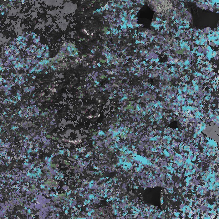
NASA EMIT 2.2 µm features, 18 Feb 2026, 60 m.
Contours every 20 m, heavy line every 100 m.
AI Bhoomi · by RurTech for Arayans LLP
Every farm traced, from soil to buyer.
AI Bhoomi reads each farm from space, advises 13,532 farmers on WhatsApp in their own language, and tags the harvest so buyers know where it came from.
Bhoomi on WhatsApp भूमि से पूछिए, अपनी भाषा में
No app to install. These are the real messages the bot sent for a 1.10-acre wheat field on 12 October 2026.
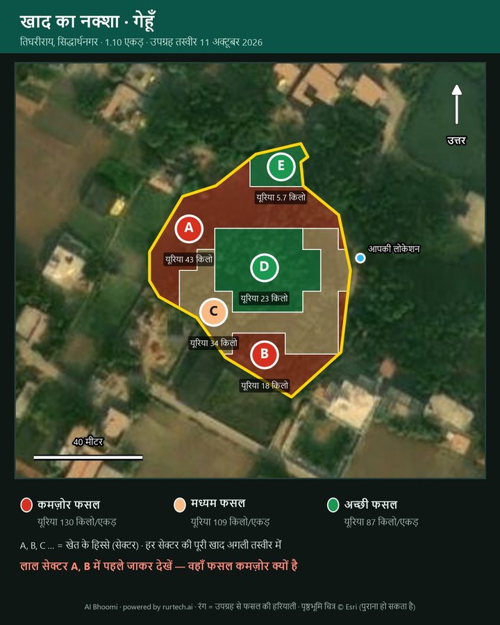
आपके खेत का खाद नक्शा — लाल = कमज़ोर, नारंगी = मध्यम, हरा = अच्छी फसल। अक्षर = सेक्टर, नीचे उसकी यूरिया।
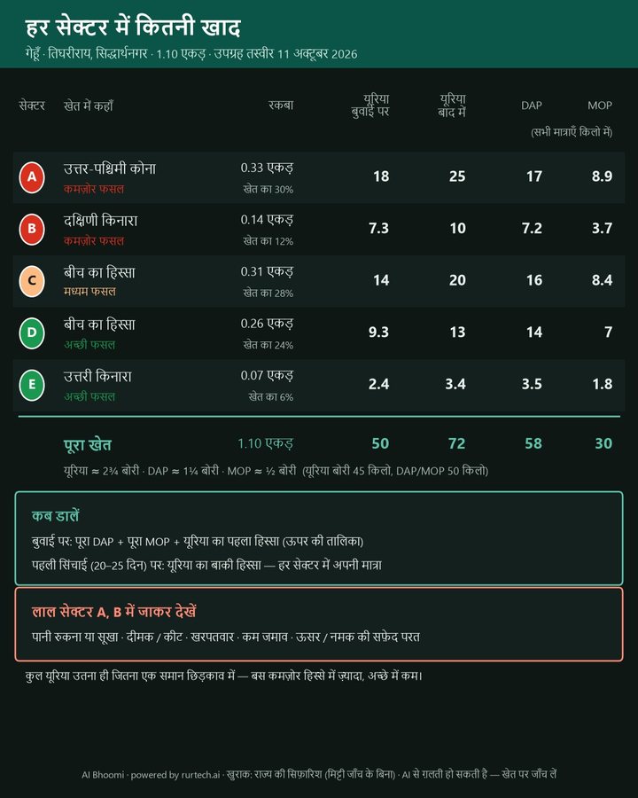
हर सेक्टर में कितनी यूरिया, DAP और MOP (किलो) — और कब डालें।
खाद का नक्शा — गेहूँ
(1.10 एकड़, तिघरीराय, सिद्धार्थनगर) · 11 अक्टूबर 2026 की उपग्रह तस्वीर से:
कमज़ोर फसल (0.47 एकड़) — सेक्टर A, B: यूरिया 61 किलो
मध्यम फसल (0.31 एकड़) — सेक्टर C: यूरिया 34 किलो
अच्छी फसल (0.33 एकड़) — सेक्टर D, E: यूरिया 28 किलो
DAP 58 किलो + MOP 30 किलो — पूरे खेत में एक समान दर से। बुवाई पर: पूरा DAP + MOP + यूरिया का 41%; पहली सिंचाई (20–25 दिन) पर: बाकी यूरिया।
लाल सेक्टर A, B में पहले जाकर देखें: पानी रुकना/सूखा, दीमक-कीट, खरपतवार या कम जमाव?
Sent to the test phone from the live bot. Text shown as sent, with the colour emoji drawn as dots. The total urea equals a flat dose; weak patches get more, strong patches less.
- Location pinFarm map and fertiliser zonesLive
- Crop photoShortlist of likely pestsLive
- Voice noteAsk in Hindi, get an answerLive
- Soil reportCard values and fertiliser tableLive
- Sell harvestOffer a lot to contract buyersPilot
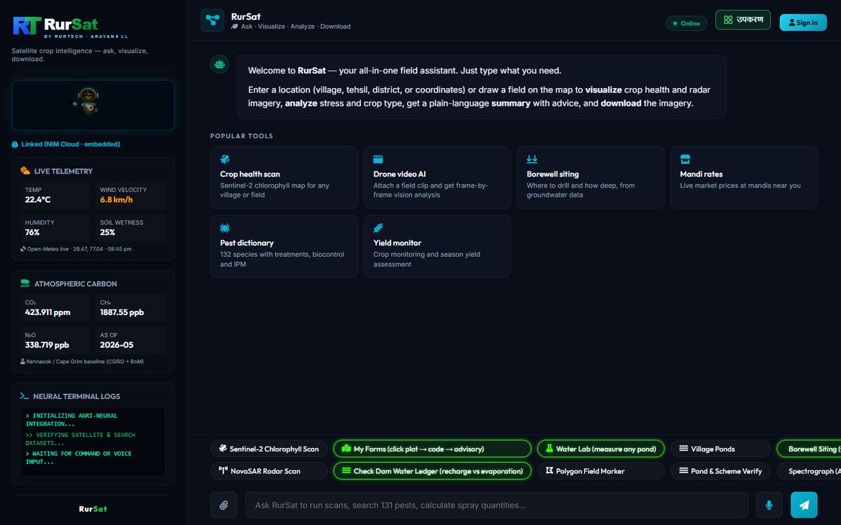
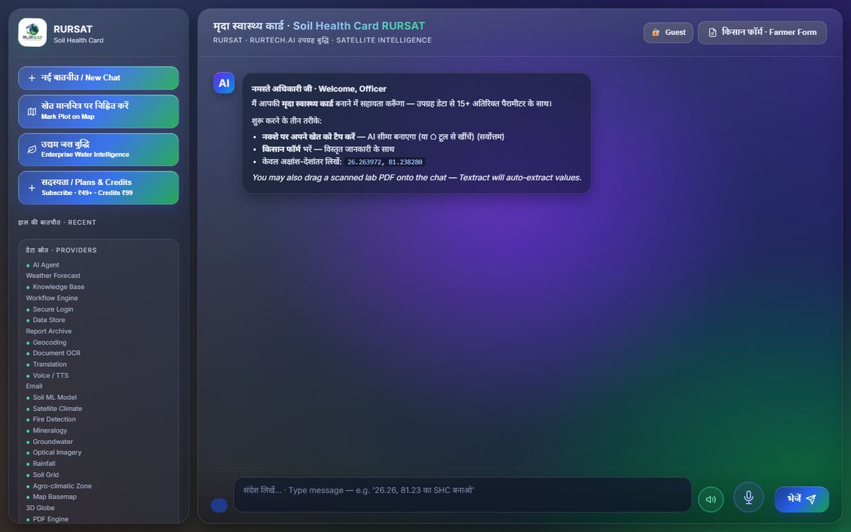
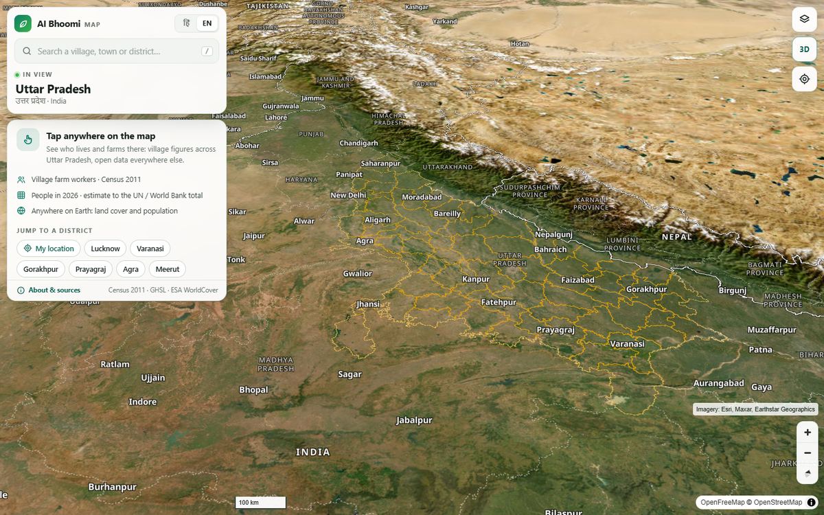
Farm to buyer मिट्टी से ख़रीदार तक, एक रिकॉर्ड
One record follows each farm from soil test to the buyer’s crate. Pick a field in Bijjawara: each has its own government lab test and a year of satellite passes.
 Bijjawara, Devanahalli taluk · Sentinel-2, 14 Oct 2026 · 1.4 km · dots at each lab test’s recorded GPS
Fields B and C are 200 m apart. The lab found pH 5.5 in one and 7.95 in the other. That is why every tagged farm gets its own soil test.
Tag the farm Live
- Farm ID
- Location
- Village
- Bijjawara, Devanahalli taluk, Karnataka
- Owner
- from the land record (kept private)
Test the soil Government lab, 2024–25
LowMediumHighThresholds as on the Soil Health CardMatch crop and seed Pilot
Watch the season Live
Grow under contract Pilot
- Buyer and crop spec
- set at sowing
- Fertiliser plan
- zone map on WhatsApp (live)
- Inputs logged
- seed lot, fertiliser, sprays
Harvest and grade Pilot
- Yield estimate
- from the season curve, checked by crop cut
- Quality grade
- at the collection centre
- Organic status
- as certified (NPOP or PGS-India); recorded, not issued by us
Transport and cold chain Pilot
- Pickup
- AI Bhoomi transport partner
- Cold chain
- temperature log, farm to buyer
Buyer scans the lot Pilot
The crate label opens this record: which farm, whose land, what soil, how it was grown.
What the farmer gets किसान के फ़ोन पर
Every picture below is real: the first two were sent by the bot; the rest are built from satellite passes over Bijjawara.
खाद का नक्शाFertiliser zone map
हर सेक्टर में कितनी खादDose card
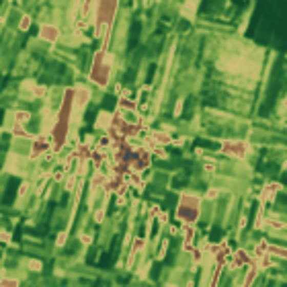
फसल की हरियालीCrop vigour
Sentinel-2, 14 Oct 2026, 10 m.
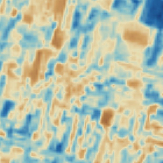
पानी की कमीCrop moisture (NDMI)
Brown is dry, blue is wet. 14 Oct 2026.

मिट्टी में लोहाIron oxides (EMIT)
NASA EMIT, 18 Feb 2026, 60 m.

मिट्टी की क्लेClay minerals (EMIT)
NASA EMIT, 18 Feb 2026, 60 m.
फसल का मौसमSeason curve
28 passes, Nov 2025 to Oct 2026. Gap = monsoon cloud.
मिट्टी की जाँचSoil card values
Field C, government lab, 2024–25.
Proof सबूत, आँकड़ों में
Checked against independent satellites, government records and held-out wells. Where the data says no, we say so.
Two satellites, same ground
NDVI from NASA EMIT (18 Feb 2026) vs ESA Sentinel-2 (16 Feb 2026), 900 of 46,784 matched 60 m pixels.
Agreement in every band
EMIT spectra resampled to Sentinel-2 bands. R² per band, n = 46,784.
Not proven yet
- Reading a single field’s nutrients from satellite. At 784 lab tests in the block above, EMIT and Sentinel-2 soil signals did not track lab pH, iron or organic carbon (ρ between −0.12 and 0.02).
- Phosphorus and potash classes. Satellite estimate matched the lab class in 50% (P) and 38% (K) of 32 fields.
- Borewell success. No skill on 31 independent wells in Chikkaballapur (AUC 0.51).
So the pilot measures it
- Lab first: a card always uses the lab value where one exists. Satellite estimates fill gaps and are marked.
- 100 GPS-tagged lab samples on the contracted acres. Each sample paired with its satellite pixel.
- Half-zone, half-flat fertiliser strips with crop cuts. Yield difference measured at harvest.
The science गीला रसायन, सूखा स्पेक्ट्रम
Lab chemistry on one side, reflected light on the other. Pick a card parameter to see the bands that carry it, on real EMIT spectra from the block above.
Absorption band depth
Kaolin clay at 2,205 nm on a red-soil field near Gaviganahalli. NASA’s L2B product reports 0.355 for the same pixel.
Crop indices
Sentinel-2 bands: B4 red 665 nm, B8 NIR 833 nm, B8A 865 nm, B11 SWIR 1,614 nm. NDVI tracks green leaf; NDMI tracks leaf water.
Two-sensor resampling
Each EMIT spectrum is weighted by the Sentinel-2 band response Sb (Gaussian, by centre and width) before the two satellites are compared.
Soil mass and nutrient gap
T target, C soil test, η build-up efficiency, c nutrient share of the product. From the AI Bhoomi amendment formulator.
Fertiliser zones
Zones are NDVI thirds of pixels at least 5 m inside the boundary. DAP and MOP stay flat.
Validation measures
Spearman ρ is the correlation of ranks. Every figure on this page states its sample size.
NASA EMIT, the sensor
| Platform | International Space Station |
| Instrument | Dyson imaging spectrometer, two-mirror telescope |
| Spectral range / sampling | 380–2,500 nm / 7.4 nm (285 bands) |
| Detector | HgCdTe, 1280 × 480, 30 µm pixels |
| Optics | F/1.8, 193.5 mm focal length, 110 mm pupil |
| Field of view / IFOV | 11° / 155 × 171 µrad |
| Slit | 30 µm × 37.2 mm |
| Ground pixel | 60 m |
| Calibration | No onboard calibrator; checked at Railroad Valley (3 Aug 2022) and Black Rock Playa |
Source: NASA/JPL EMIT webinar, 28 June 2023. The 294 reference spectra EMIT matches against are the same library listed in the AI Bhoomi workbook.
Uncertainty is distributed with every product level.
Pricing कीमत, हर किसान की पहुँच में
The prices the bot quotes and RurSat charges, as set in the live system. Every new farmer starts with 7 days of full service free, with no card.
Full service. No charge, no card.
Farm under 1 hectare (2.47 acres). One payment buys 30 days.
Farm above 1 hectare, any size. A farmer never pays by the acre.
Companies, CSR programmes, FPO businesses. All-farm dashboard and reports, no minimum area. Billed to the organisation, never to its farmers.
Free after the trial
- Weather, MSP and mandi prices · the answers that decide a farmer’s income
- Soil, pests, crop health and borewell advice
- Fertiliser cost, crop economics, KCC limit, crop insurance
- Land record lookup and adding a farm plot
Paid plans add high-resolution farm imagery, full-field PDF reports and charts.
Pay as you go
- One PDF report₹1 each, for a farmer without a planLive
- API and SDK credits₹99 pack, about 82 sessionsLive
- RurSat web toolsFree while in testingTesting
Prices in Indian rupees.
Every service सभी सेवाएँ, एक जगह
Everything RurTech runs today, on rurtech.ai. Each link opens the live service.
Farmers
- AI Bhoomi on WhatsAppFarm map, fertiliser zones, pest photo check and soil report, in Hindi.
+91 96706 70444 - RurSat field co-pilotCrop scan, borewell siting, mandi rates, pest dictionary.
us.rurtech.ai - AI Bhoomi mapTap any village: farm workers, population, land cover.
bhoomibot.rurtech.ai/map - Field TwinWind, windbreak shelter, spray drift and rain runoff on one field.
us.rurtech.ai/fieldtwin
Soil and land
- Soil Health Card assistantFor officers: a card from a pin, a lab PDF or coordinates.
aibhoomi.rurtech.ai/rursat - AI Bhoomi soil portalमिट्टी पोर्टल: खेत, मिट्टी और सलाह एक जगह।
aibhoomi.rurtech.ai/portal - AI Bhoomi field portalField boundaries, land records, soil, crop and water.
us.rurtech.ai/field - Soil Field PortalLand, soil and crop verification for rural credit appraisal. Sign-in.
soil.rurtech.ai
Water
Satellite and climate
Company अब तक का काम
Started in late 2025 without institutional capital. Who runs it, what it has sold, and what has been built so far, with dates.
Saddam Hussain
Founder & CEOMore than ten years in industrial audits, compliance frameworks and quality management across sectors, where he saw how often big decisions rest on late, costly or unreliable data.
He grew up in a farming family in rural India and started RurTech to close the gap between the data that exists and the farmers who need it.
- Company
- RurTech for Arayans LLP
- GSTIN
- 09ABMFR4400N1ZS
- DPIIT
- DIPP229625
- Next
- RurSat Spectral Research Labs Pvt. Ltd., with BMS AgriAllied Ventures Pvt. Ltd.
- Office
- Viraj BBD Towers, Vibhuti Khand, Gomti Nagar, Lucknow 226010
Traction
So far
- RurTech starts, bootstrapped. AWS Activate credits.
- Selected in the UIDAI Biochallenge.
- Startup in UP recognition. Incubated at AIC-BIMTECH.
- NVIDIA Inception member.
- Ministry of Agriculture AI Hackathon, stage 2.
- Startup in UP sustenance allowance.
- DPIIT recognition. Showcase at the National Space Technology Conclave, referred by IN-SPACe.
- Farmer pricing set: 7 days free, ₹30 a month, ₹999 a year.
- GPS-stamped village sessions. Sidhaur (UP), Borkhedi, Nayagaon and Nagda (MP).
- Fertiliser zone maps sent on WhatsApp. Groundwater, Water Lab and Field Twin tools open on us.rurtech.ai.
- First enterprise order, Aditya Birla Group.
- AI Bhoomi village map for Uttar Pradesh and the world.
- Bot moves to +91 96706 70444. 13,532 farmers, 39,906 acres.
Recognised by
Programmes and registrations on file.
Book a consultation हमसे बात करें
For district and state programmes, companies, CSR teams, FPOs and data partners. The form opens WhatsApp Business with your enquiry filled in. We reply within 24 hours on business days.
- Farmers
- AI Bhoomi +91 96706 70444
- General
- info@rurtech.ai
- Sales
- sales@rurtech.ai
- Support
- support@rurtech.ai
- Careers
- carrier@rurtech.ai
- Office
- Viraj BBD Towers, Vibhuti Khand, Gomti Nagar, Lucknow, UP 226010
- Follow
- Twitter · LinkedIn · Facebook · Instagram